Savannah Resources plc (LON:SAV), the AIM quoted resource development company, has today announced that the first phase of the exploration programme aimed at defining a JORC resource at the Mina do Barroso lithium project, located in northern Portugal (‘Mina do Barroso’ or the ‘Project’) (Figure 1) has now been completed. Savannah has a 75% interest in Slipstream Resources Portugal Unipessol Lda, which is the registered holder of the Mina do Barroso mining licence. To view the press release with the illustrative maps and diagrams please use the following link: Phase 1 Mapping and Drill Programme
HIGHLIGHTS:
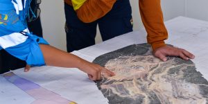
· Completed the first phase of geological mapping targeted at defining the extent of the lithium bearing pegmatites at Mina do Barroso in preparation for drilling
· Mapping undertaken across three primary target areas – Grandao, Reservatorio and NAO – which have been shown to have relatively high grades of lithium oxide (‘Li2O’) with drill results up to 1.67% Li2O over significant widths
· Mapping has expanded the surface footprint of the known pegmatites:
o Reservatorio, over 600m in strike with a maximum width of 85m and the potential for a stacked sequence with some thinner 10m-15m wide parallel bodies
o Grandao, series of at least 3 stacked sub-horizontal pegmatite bodies 10m-30m width with a strike of 400m in a North-South and 200m in an East-West direction
o NOA, potentially three stacked moderately dipping pegmatites 5m-30m in width which can be traced for at least 300m in strike
· 3,000m-5,000m reverse circulation (‘RC’) drill programme is scheduled to start during the week commencing 17 July 2017 due to drill rig availability, focusing on defining a JORC mineral resource estimate to support a potential mine development
· Further mapping is also planned at Mina do Barroso to define other lithium bearing pegmatites within the enlarged project area, this work is expected to be completed during Q3 2017
Savannah Resources Plc CEO, David Archer said: “We’re pleased that our mapping, as a preliminary to drilling, has extended the surface expressions of three major lithium bearing pegmatites at Mina do Barroso. This will help us in our drill hole targeting for our upcoming drill programme as we look to ultimately define a JORC resource to support mine development. Based on previous drilling and channel sampling, the three pegmatites mapped have been shown to have relatively high-grades of Li2O and we look forward to converting this into a commercial resource.”
Figure 1. Project Location Map

Technical Data
A brief high-level simplified description of the information collected is provided below.
Reservatorio
Mapping at Reservatorio has identified a relatively large pegmatite body, which has been traced for over 600m along strike in a NE-SW direction with the pegmatite body reaching up to 85m in width at its widest point. It is difficult to determine from outcrop, but combining this information with the historical drill holes the body appears to dip at around 30 degrees to the NW. Mapping has also indicated the possible presence of at least one parallel pegmatite between 10m-15m in width which could indicate that the pegmatite bodies may be part of a stacked sequence, but drilling will be able to confirm this. It is important to note that due to the low angle of the dipping pegmatites the surface expression could potentially overestimate the true width of the body.
Rock chip sampling by Savannah during April 2017 targeting spodumene bearing pegmatites has confirmed the prospectivity of the Reservatorio Lens as the samples ranged from 0.87% Li2O to 2.7% Li2O and averaged 1.6% Li2O and significant past drilling results include:
· 32m at 1.16% Li2O from 20m in RES019
· 12m at 1.6% Li2O from 1m in RES030
· 10m at 1.5% Li2O from 2m in RES01 (EOH)
Drilling currently planned at Reservatorio will include 14-32 angled RC holes varying from 50m-120m in depth depending on results on a nominal 80m line spacing and 40m hole spacing along each line (Figure 2).
Figure 2. Summary map of Reservatorio showing new mapping, past exploration results (previously released 25/05/2017) and planned RC Drilling with selected significant historical drill results

Grandao
The Grandao area contains some of the most extensive pegmatite outcrop in the Mina do Barroso project area with mapping defining a series of sub-horizontal stacked lenses, with at least three pegmatites in the stack ranging from 10m-30m in width. It is difficult to determine due to the angle of the outcrop and the hills in the area but mapping suggests the bodies could strike as much as 400m in a North-South direction and over 200m in an East-West direction.
Recent rock chip sampling by Savannah in April 2017 in the area returned results of 1.41% Li₂O to 2.07% Li₂O with an average 1.79% Li2O, the highest average grade for any of the Mina do Barroso aplo-pegmatites. Significant results from past drilling include:
· 16m at 1.35% Li2O from surface in GRA05
· 17m at 1% Li2O from 7m GRA15
· 8m at 1.43% Li2O from 32m in GRA028
Drilling currently planned at Reservatorio will include 12-30 vertical RC holes varying from 50m-120m in depth depending on results on a nominal 80m line spacing and 40m hole spacing along each line (Figure 3).
Figure 3. Summary map of Grandao showing new mapping, past exploration results (previously released 25/05/2017) and planned RC Drilling with selected significant historical drill results

NOA
Preliminary mapping at NOA has identified what looks to be a stacked sequence of pegmatites ranging from 5m-30m in width, with at least three parallel bodies being defined. Mapping and historical drilling suggest the bodies dip between 30-50 degrees to the north and outcrop can be traced for at least 300m making this a priority target.
Rock chip sampling by Savannah during April 2017 including continuous rock chips and scattered rock chips average 1.5% Li₂O. The continuous rock chipping outlined significant widths of mineralisation including:
· 30m at 1.18% Li2O in NOA 1
· 30m at 1.35% Li2O in NOA 2
· 35m at 1.67% Li2O in NOA 3
This sampling confirms the prospectivity of the NOA area with a series of pegmatites in the area which require further detailed and systematic exploration:
· 22m at 1.1% Li2O from 3m in NOA01 (EOH)
· 15m at 1% Li2O from 7m in NOA13
Figure 4. Summary map of NOA showing new mapping, past exploration results (previously released 25/05/2017 and planned RC Drilling with selected continuous rock chips (green box’s) and historical drill results (orange boxes)

Drilling currently planned at NOA will include 8-20 angled RC holes varying from 50m-120m in depth depending on results on a nominal 80m line spacing and 40m hole spacing along each line (Figure 4).
Ongoing Mapping and Exploration Programme
Further mapping and sampling of the area will be conducted initially focused on the over 20 existing pegmatite bodies followed by grid mapping of the remainder of the tenement in a search for any new pegmatite bodies.
Competent Person and Regulatory Information
The information in this announcement that relates to exploration results is based upon information compiled by Mr Dale Ferguson, Technical Director of Savannah Resources Limited. Mr Ferguson is a Member of the Australian Institute of Mining and Metallurgy (AusIMM) and has sufficient experience which is relevant to the style of mineralisation and type of deposit under consideration and to the activity which he is undertaking to qualify as a Competent Person as defined in the December 2012 edition of the “Australasian Code for Reporting of Exploration Results, Mineral Resources and Ore Reserves” (JORC Code). Mr Ferguson consents to the inclusion in the report of the matters based upon the information in the form and context in which it appears.


