Panthera Resources Plc (LON:PAT), the diversified gold exploration and development company with assets in West Africa and India, has announced its plans to recommence fieldwork at its Bido Project, located in the prolific Boromo greenstone belt within the Birimina terrain of Burkina Faso.
Highlights
· Geochemical survey to be conducted in the south-central area of the licence
· Programme to define and rank additional drill targets
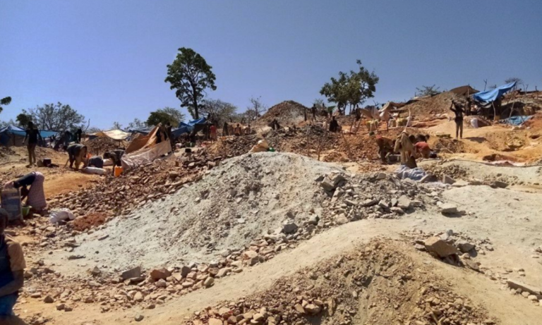
· Multiple gold prospects identified across the Licence area including extensive historical artisanal workings
Following the recent award of the new Bido Licence as announced on 6 October 2020, a field visit to the Bido site is currently in progress to assess the access to the survey area and to obtain clearance from local officials to commence a full fieldwork programme.
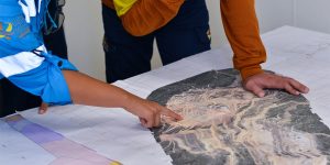
An initial programme of soil sampling and regolith mapping is proposed to start later in November and to be concluded by late January 2021. The programme is anticipated to comprise 1350 samples and cover an area of approximately 12 km2. In addition, Panthera is currently evaluating various plans to undertake geophysical surveys at Bido in the New Year.
These work programmes aim to define and rank drill targets for a drilling programme which is expected to commence in the first half of 2021. This is in addition to other potential drill targets which have already been identified at the Bido Project including Kwademen and Kwademen South.
Several high order gold in soil anomalies and artisanal workings are located on the northern edge of the survey area. A gold in soil survey was previously proposed in this area, however, it was postponed due to the onset of the wet season and followed by COVID-19 pandemic. During this delayed period, the Company has continued to evaluate the available data relating to this target area and will provide an update in due course.
About Bido
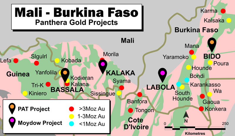
The 100km2 Bido Licence is located in Burkina Faso, approximately 150km West South West of the capital Ouagadougou. The Licence is within the prolific Boromo Birimian greenstone belt that hosts multiple >1 million ounces (“Moz”) gold deposits including Konkera (3.3Moz), Gaoua (3.4Moz), and Poura (1Moz). Also, a significant base metal deposit, Perkoa (5.5Mt @ 12% Zn), is located approximately 30 km north of the project area.
Previous exploration activity in the area by BUMIGEB (a Burkina Faso government and United Nations joint venture), Carlin Gold Corporation, and the Company’s current JV partners, Messrs Sanou, has provided an extensive technical data set. This work, combined with the location of past and present artisanal gold mining activity, has resulted in the identification of multiple priority gold prospects at Bido including:
· Somika Hill
· Kwademen
· Kwademen South
At Kwademen, historical work has returned several encouraging gold intercepts in broadly spaced drilling (~200m to 300m line spacing) including:
· 16m @ 1.07g/t Au from 69m
· 10.4m @ 2.14g/t Au from 191m
· 23m @ 1.53g/t Au from 143m
· 2.25m @ 7.74g/t Au from 155.8m
· 1.45m @ 16.0g/t Au from 52m
· 1m @ 40.0g/t Au from 90m
Soil sampling conducted by Panthera Resources over the last two years has shown that this drilling is located to the west of the main gold in soil anomaly and also west of the area of artisanal mining activity. The main part of the gold in soil geochemical anomaly and associated artisanal gold mining activity can thus be seen to represent a highly prospective ‘walk-up’ drill target, with over 1,000m of strike potential.
Another zone of artisanal gold mining activity is located to the south of Kwademen, possibly associated with a fault offset continuation of the main Kwademen mineralisation.
This large area of workings (>1.5km strike) is focused beneath a laterite hardpan which masks the soil geochemical signature of underlying mineralisation and hence the mineralisation does not show up as a soil geochemical anomaly. These laterites show up as high total count areas in the regional radiometric data and. can be interpreted as laterite hardpan which may mask any underlying gold mineralisation whereas the low total count areas are most likely suitable for soil sampling to be effective.
Notwithstanding the absence of a gold in soil geochemical anomaly, the very extensive artisanal mining activity beneath the laterite hardpan suggests this area represents an excellent gold target that has not been previously drill tested.


