Bluejay Mining plc ORD 0.01p, (LON:JAY) the AIM and FSE listed company with projects in Greenland and Finland, is pleased to provide an overview of its plans for the 2017 field season at the Pituffik Titanium Project in Greenland (‘Pituffik’). Planning for season 2017 is nearing completion, with the relevant applications having been already lodged with the Mineral Licence and Safety Authority (‘MLSA’) in Greenland. Further details on the approvals process will be announced over the coming months. To view the press release with the illustrative maps and diagrams please use the following link: Bluejay PDF
Pituffik has been independently proven to host the highest-grade mineral sand ilmenite project globally, and Bluejay, through its 100% owned Greenlandic domiciled subsidiary, Dundas Titanium A/S (‘Dundas’), intends to fast-track the project into initial production in 2018. Accordingly, three primary work programmes are planned for the 2017 field season:
1. Expansion and upgrade of the resources to be facilitated by both auger and sonic drilling
· Pituffik currently has an Inferred resource of 23.6Mt at 8.8% ilmenite (in situ), which includes a high-grade zone equal to 7.9Mt at 14.2% ilmenite within an SRK Exploration Target of between 90Mt and 130Mt with an in-situ TiO2 grade of between 6.3% and 8.4% ilmenite. This resource comes from an area that represents only approximately 17% of the raised beach area at Moriusaq
· Focus will be on increasing the total mineral inventory at the project to demonstrate the global significance of the project in terms of tonnage. Upside potential available via Interlak, the offshore terrace, as well as the additional 25km of raised beach which have not been included in the maiden mineral resource calculation
· 400 drill holes have been planned with drilling to commence in July
2. Proof-of-concept bulk sampling programme and production of geotechnical information for civil construction ahead of the potential constructing of supporting infrastructure at Moriusaq in early 2018
· Bulk sample targeted for H2 2017, designed to include dredging a small amount of material from the shallow marine / drowned beach environment, thereby proving Bluejay’s ability to deliver product to customers
· Target group for the bulk sample identified. Discussions on mechanics of delivery and other technical support expected to begin in due course
3. Bathymetric survey of a shipping channel to allow a bulk carrier to call to Moriusaq
· Geological Survey of Denmark and Greenland executing side scan sonar and deep bathymetry surveys designed to identify shipping channels for transport logistics
Bluejay Mining ORD 0.01p CEO Roderick McIllree said, “Having now proven that Pituffik hosts the highest-grade mineral sand ilmenite project globally our attention will focus on this seasons deliverables. The objective of these work programmes will support the finalisation of the various studies and offtake partnering that will facilitate moving the Pituffik Titanium Project into production. This years’ programme at Pituffik is designed to close out many aspects of the feasibility study as well finalise the various components of the exploitation application process. We remain committed to a fast track development of Pituffik and to ensuring the project is developed to the highest environmental standards as well as being sustainable in the long term. With these work programmes in the pipeline I am confident that 2017 will continue to be a highly successful year for Pituffik and the Company.”
Further Information
Pituffik Titanium Project
A selection of drilling and earthmoving equipment has either been purchased or hired by the Company to support the drilling, bulk sampling and general field operations. In July, a barge will be dispatched from Nuuk to the Pituffik project area, laden with all the equipment for the field season. Bluejay has purchased a CRS-T sonic drill and tooling by Eijkelkamp SonicSampDrill, a part of Royal Eijkelkamp. Sonic drilling uses vibration to allow the drill string to pass through unconsolidated sediment, and remove an undisturbed sample from the inner tube. This sample will be logged for its sedimentary units and heavy mineral content above basement and the sample send for analysis. Eijkelkamp SonicSampDrill products are the result of industry changing innovations, designed by people committed to continual improvement. The company’s products are safer and more ergonomic than the industry standard.
Drilling will commence outside of the maiden resource and exploration target, at Interlak. The initial drill locations were identified by exploratory trenching last year, and returned some of the highest grade (65%) ilmenite samples from the 2016 exploration programme. The auger drill will be used to scout in advance of the sonic drill and reach more challenging locations such as the large raised beach north of the Interlak river delta.
Once drilling at Interlak is complete, equipment will be transported to the eastern part of the Moriusaq beach, which was not drilled last year. Drilling will then advance westward towards the basecamp and exploration target near Moriusaq.
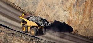
Bulk sampling will be completed in a variety of locations on both raised and active beaches. A 20t excavator, loader and some ancillary equipment will be tasked with mining, screening and bagging the material produced ready for export. This material will be used for metallurgical pilot plant trials and customer acceptance. Excavation sites on the active beaches will be surveyed and monitored for sediment recharge rates over the field season and subsequent work programmes.
Both environmental and social work programmes will continue this year. During 2017, aerial surveys will be used to aid in fieldwork at several times through the year field work for the environmental base line studies will be conducted in mid-August where collection of marine, freshwater and terrestrial samples will determine background values. In addition, aerial surveys in the license area will be performed.
Figure One: Map of Interlak east with existing high grade exploratory trenches and planned drilling (View PDF)
Figure Two: Map of Interlak west with planned drilling (View PDF)
Figure Three: CRS-T sonic drill by Eijkelkamp SonicSampDrill (View PDF)
Figure Four: Map of Moriusaq east showing planned drilling (View PDF)
Figure Five: Map of Moriusaq existing auger sample locations and planned drilling (View PDF)
